
Language switcher


Learning GIS
What Is GIS?
Formally known as the Geographic Information System, it is a streamlined gathering and organisation of data, particularly in the field of geography. Generally it forms an integration between many of the fundamental principles of science and social awareness. The principle function of the Geographic Information System is to create highly detailed maps. Further it creates three dimensional layouts which highlight particular features combined with additional data regarding topics as diverse as the type of soil in a certain region, the population and social influences.
The Benefits Of The Geographic Information System
Analysis within the system leads to a greater understanding of the natural world and the impact of social development. Obtaining such a clear insight into the correlation between layers of information in all aspects of society leads professionals to make wiser judgements and decisions.
Although the presence of the Geographic Information System has been in existence since the 1960’s, it is only since the development of the internet that it has begun to gain a much higher profile. Now it is even becoming a major industry leading to a massive increase in professional careers.
Geographic Information System Careers

The use of spatial intelligence is rapidly increasing as analysis systems and information are coordinated into a vital research facility that is internationally accessible. A sophisticated network of geographic analysis and data gathering is developing on a global scale. This has prompted a wave of new careers including:
- Mapping technicians
- Climatologists
- Specialists in applications
- Teachers
- Software programmers
- Engineers
As a result education and qualifications in Geographic Information Systems are now available on an unprecedented level.
Suggested Careers In Geoinformatics
- Programmers
- Cartographers
- Surveyors
- Climatologists
- Spatial Analysts
- Teaching
- Town Planning
- Telecommunications
How Can I Learn About The Geographic Information System?
Anyone can learn the science of this fascinating subject through a variety of methods including attending courses at universities, colleges or studying online. Much of the emphasis on learning GIS is based on the ArcGIS software which has been developed by ESRI (Environmental Systems Research Institute). Esri is a Californian company founded in 1969. ArcGIS is a database primarily of geographic information and enables users to create sophisticated maps involving many layers of data that assist in solving many regional and global problems.
Where Can I Study GIS?
Geoinformatics combines technology and science to solve problems such as those connected with cartography and land use. All the major universities in many countries throughout the UK, Europe and the rest of the world have degree courses designed to integrate the study of Geoinfomatics.
Contacting a university direct or online will quickly reveal their most popular choices in this field. In addition related subjects include geography, telecommunications, healthcare and geology.
Online Courses In Geoinformatics
There are many online courses available that charge a set fee. Additionally all are easy to find using the search facility. There are also many free courses. An overview of providers for online courses including consumer reports is available on Testberichte.com (German website). Some are organised by various institutions and universities such as Leicester University. Also MOOC (Massive Open Online Courses) provide excellent learning at a distance covering topics such as cartography, spatial analysis and mapping.
Online ESRI Courses

Some of the institute’s online courses are fee-paying but there are more than ninety others that are completely free of charge. Study is largely based on the ArcGIS software and there are some modules that include a basic information guide or how geoinformatics can be used in teaching and cartography.
Other Free Courses In Geoinformatics
Searching online for courses in the Geographic Information System quickly finds a host of free courses. For instance QGIS from GeoAcademy that includes data management, spatial analysis, remote sensing and cartography.
OCW (Open Course Ware) allows students to work their way through the different modules at their own pace concentrating on the list of topics in an order that suits them. Many OCW courses are freely available online from universities such as Yale and Michigan in America.
Where To Study Geoinformatic Courses
- Universities
- Colleges
- Massive Open Online Courses (MOOC)
- Open Course Ware (OCW)
Geographic Information System Workshops In Europe
There are numerous workshops in Europe where you can study GIS. Especially searching online is an easy way to locate short workshop courses which are held by various educational and commercial enterprises in all the major cities including Basel, Paris and London.
Most Popular Global GIS Events
One of the first events for a Geographic Information System conference was organised by ESRI in 1981, long before the introduction of the internet which has helped to popularise the subject. The Institute now holds an annual conference in San Diego. Further there are numerous conferences and seminars held all over the world connected with geoinformatics.
GISRUK Events
The GISRUK series are internationally recognised conferences on Geographic Information System research that have been held in various locations within the UK and Ireland since 1993. They are attended by academics, business executives and government representatives from the UK and Europe in addition to other global countries. Also similar conferences are held throughout the world.
Subjects Discussed At Events Include
- Geography
- Geology
- Archaeology
- Ecology
- Engineering
- Public Health
World GIS Day
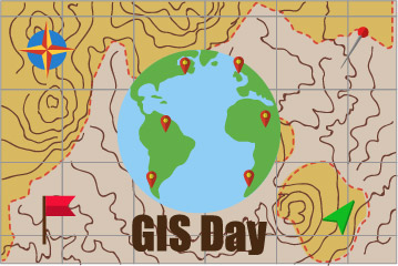 The day involves a series of coordinated events throughout the world to highlight the progress the integrated systems are making in dealing with global issues.
They are a valuable series of opportunities to bring the concept of Geographic Information Systems to the public’s attention. Many events are centered around schools to promote education in this vital subject.
An Annual Global Event
The first GIS day was held in 1999 and has since grown in popularity. Professionals from every branch of Geographic Information Systems share their enthusiasm and knowledge with local communities to highlight the importance of analytic maps. Combined with technology, spatial intelligence and map making involving data from many different sources are continue to enhance society and promote education.